In early November 2017, I found myself faced with an unexpected stay in Happy Valley-Goose Bay, Labrador for a couple of days due to the Goose Bay Airport runway closure. Rather than get all worked up about this extra stay in a rather remote Canadian location, I fully embraced it!
The day was cold but sunny and that could only mean one thing – go for a run.
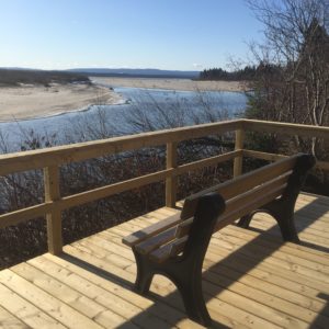
Sit and enjoy the view or run past
I did a bit of research on near-by locations and discovered that where I was staying, near the Labrador Health Centre, was only a short distance from a fabulous new recreation area, with trails! Say, no more… I got my gear on (including a down jacket and sunglasses), tied up my running shoes and headed out.
My destination was Birch Island. It was a few short kilometres to get to the trailhead, so off I went. I generally don’t like to run next to busy roads, so I headed down some back roads and happened upon the Labrador North Chamber of Commerce Visitor Information Centre.
What better place to stop and ask about my planned route?
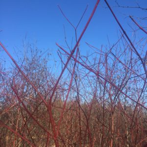
Strikingly red dogwood branches
Out came the friendly hospitality and a takeaway map! Apparently, I had selected right, Birch Island was the place to go! There were several kilometres of recently installed boardwalk that transect the Conservation Area over swamps and bogs, through black spruce forests, past birch trees and next to the mighty Churchill River. Well, that sounded like a great place to run!
I ran past the multi-denominational Happy Valley Cemetary (great places to run, BTW), past the Melville Public Library, which I visited on my way back, and past the police station (no problems there). Unfortunately, I did have to run on the shoulder of the busy Hamilton River Road before I turned onto the much calmer gravel Birch Island Road. A large wooden archway grandly announced the entrance to the park.
I ran over a bridge, over Birch Island Creek – an acknowledgment that this was indeed an island, past the first boardwalk, which I eventually returned to on my way back up the road, with the end of the road destination seemingly more inviting. Indeed it was. The road terminated in a parking area with vistas of the mighty Churchill River and the Mealy Mountains in the distance.
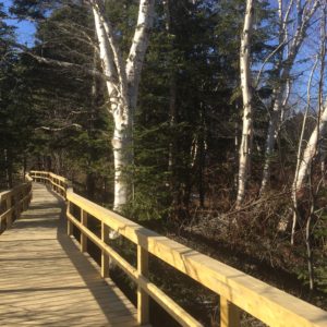
Fabulous boardwalk trails
I took the lower boardwalk from there. It was magnificent! The sky was a brilliant blue as I ran past black spruce trees, plenty of birch trees (thus the island’s name), red branched dogwood shrubs, and up-close and personal views of the Churchill River. The wooden boardwalk and numerous river, swamp, and bog viewing decks were mostly ice-free in early November and made for a wonderful running surface. However, there were places where the shade preserved some of the ice, created by previous snow falls and crushed down by numerous walkers (and maybe runners), which caused somewhat treacherous running, thus slowing me down a bit. Did I care? No!
I met a few other people out for a stroll, but no other runners. Perhaps it was because of the time of day – mid to late morning on a weekday, but what a great place to run! There are currently multiple kilometres (my estimate is 5K) of wheelchair and stroller accessible board-walked trails, which are bounded in most places by side railings.
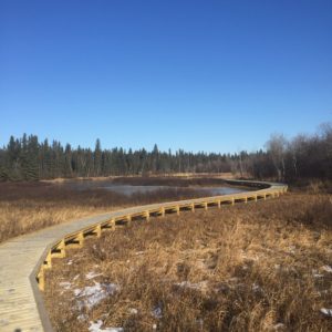
Boardwalk through swamp and bog
In a few areas, specifically near a very large river sandbar, there are no rails, but convenient stairs onto the sandy area, which I took, of course! However, swimming in this and nearby areas have been reportedly very dangerous with the shifting sands beds. This, of course, was not a concern for me as there was no way I was going for an icy-cold water swim!
The boardwalk trails through the swamps and bogs offer vistas of vast areas of beautiful low shrubs (dogwood, Labrador tea, and willow), plus numerous grasses and mosses. Unfortunately, many of the flowering plants were not visible, given the time of year. I imagine that Spring and Summer could be spectacular, for flowers. Both the trails ended abruptly, but you could see that the plan was to continue with more boardwalk in the future, perhaps joining the two trails for a full loop.
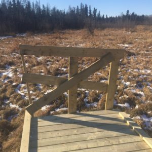
The end of the boardwalk, with potential for more
A little background on Birch Island, as I recently heard on a recent CBC radio Labrador Morning podcast, was that this area was settled from the 1940s to the 1960s. Prior to that, a small community of labourers and their families were situated near the Goose Bay Air Force Base, at Otter Creek. When it was determined that it was too close to the Base, the community was relocated to Birch Island and Happy Valley. Then in the 60’s those who settled on Birch Island were again relocated, this time into Happy Valley-Goose Bay. Why this was, I’m not sure, unless the Island floods often, which would not surprise me, given its location in/near the Churchill River and its extensive low-lying riparian habitat. At the moment, there are no human inhabitants on Birch Island.
This area is now a Conservation Area managed by Healthy Waters Labrador. It is home to numerous birds and large mammals, e.g. beaver and moose, although, alas, I did not see any of those animals. An archaeological study of the area’s “recent past” is being undertaken by Memorial University MA student Julia Brenan, as featured in the podcast.
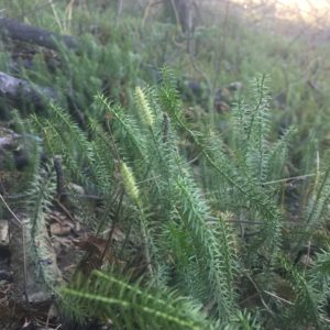
Lycopodiums
Plus as I mentioned above, the plants in the area are wonderful too. Especially check out one of my favourites, the Lycopodiums! You’ll have to look down on the forest floor for these, but there are great swatches to observe and ogle if you are so inclined.
The Healthy Waters Labrador group is currently running a Go Fund Me Campaign to raise funds for further wetland restoration and boardwalk construction. It would be wonderful to see both ends of the two boardwalk trails connected so that a large loop could be completed. I presume that is the plan.
If you ever find yourself in Happy Valley-Goose Bay or if indeed you live there, do head down to Birch Island and wander along the sturdy wooden boardwalks and enjoy the vistas and the tranquillity of the area. Although I ran on the boardwalks, it might not be prudent to do this during times when there might be many walkers there. This is an area where all can enjoy!
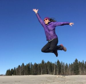
Jumping for joy next to the Churchill River


Leave a Reply