This is sign when you enter the park:
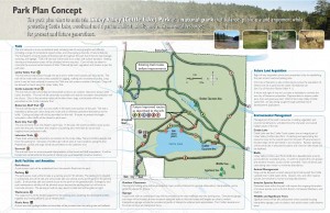
The map only shows the trails inside the designated park, but there are lots of trails in the surrounding undeveloped areas. Along some of the trails and at the edges of the existing park, there are a few signs that indicate that you are leaving the park, but when the trails look good, why stop? I did note, however, that this map is a “Park Plan Concept”, with lots of phrases like, “This trail will provide…”, “…access will be controlled”, and “Significant trees will be left undisturbed…” In other words, it is a work in progress. Plus I noted the very positive statement on the map, “Future Land Acquisition”.
The 1100 acre Linley Valley has been a wilderness gem in the middle of the city that many Nanaimoites have long wanted to preserve – most likely in its entirety. At the same time, housing developers also want to get their dibs on this lovely property. The city park first came into existence in 2003, after much hard work by NALT, with 146 acres preserved as the Linley Valley (Cottle Lake) Park.
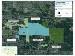
Over the years since its initial park status, residential development continued to slowly encroach into the non-preserved areas, with citizens protesting louder and louder. Finally in May this year, the City of Nanaimo councillors, in their wisdom, voted to spend $9 million and purchase up to 221 acres – mostly to the west of the current park – creating a continuous park network of 367 acres.
Now perhaps the wording on the sign can change from future tense to present tense and the map can expand to include the new areas. However, a look at a map of the entire valley, showing existing park and recent acquisitions, still shows lots of undeveloped land still to the eastern side. Who will get the rights to this area? Will this be the next city park purchase or development?
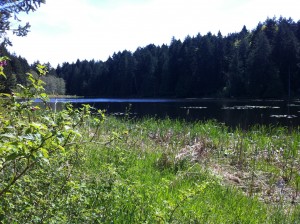
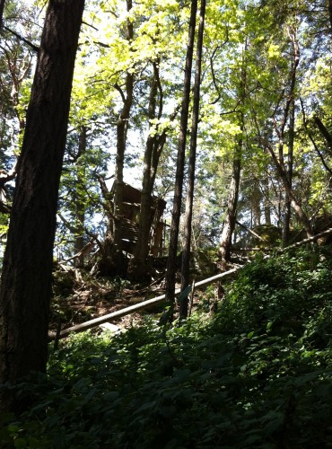
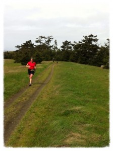
Many of the current trails – especially the ones around Cottle Lake – are wide and very accessible to runners, walkers, cyclists, and strollers (the stairs, at least at the Rock City Road entrance, do present a bit of an encumbrance to wheelchairs – perhaps something will change there, eventually). There are also many undeveloped trails, which are like a capillary system throughout the area. Some of these look like deer trails; some lead to tree house structures; some end where there is a fire pit and evidence of other activity with bottles and cans scattered about. In one place there are the remnants of a burnt out four wheeler – makes you wonder what’s the backstory there? And, unfortunately as what happens often in undeveloped areas, adjacent to residential developments, there are few garbage dumps too (sigh, seriously people!). Ultimately, all these areas can be tidied up and the trails can eventually be developed into wider paths, but for the moment, the smaller, tantalizing trails are fun to explore and yes, get lost on.
It is very easy to get lose your way in this park on these unmarked trails, but it is also pretty easy to discover roughly where you are. The majority of the park is on the north side of the valley, with Cottle Lake being at the bottom, south side of the valley. Therefore, when you are there, running uphill pretty much means heading north, running downhill means heading towards the lake. Running on more or less flat areas, means you are heading either east or west. The current north, south, and west park and “parklike” areas boundaries are more or less defined with roads or residential properties; the eastern side, not so much (at least via my explorations to date).
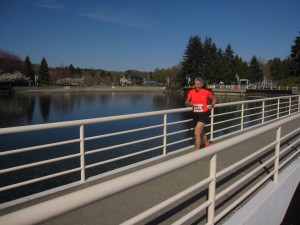
When I ran with Penny, a few weeks ago, we ran the wonderful root and rock laden, dirt-with-a-few-bridges, Lakeview Trail (a trail runner’s dream terrain) on the south side of Cottle Lake, eventually joining with the main Linley Valley Trail and continued east to the Linley Road entrance. Part of this trail is outside the park boundary, but is still a well groomed trail. We doubled back and then headed north up the Burma Rd. Trail. Rather than head back down that same trail, we chose to take the less developed, single track Eco Trail heading east and south (also a trail runner’s delight), which was quite steep, but often opening up onto wonderful rocky moss laden knolls. This trail eventually intersects the Linley Valley Trail and then the Lakeview trail along the north side of Cottle Lake, ultimately returning to the stairs and Rock City Road. Total run distance that day was 8.5K. Sorry, I did not record the time this took – probably 1.5 hours – but when you are exploring and looking at wildflowers and vistas, does that matter?
My more recent run with Stephanie again started on the Lakeview Trail on the south side of Cottle Lake, but rather than heading over to Linley Road, we headed east along the Linley Valley Trail and up the Burma Rd. Trail. Being far too groomed for us rugged trail loving gals, we took a left onto a less developed trail, heading west. This is where the getting lost happened! These trails sometimes lead to dense bush, cliffs and the aforementioned dubious-intentioned sites, plus we may have run the Bickerton Bluff Trail. All very fun, but when the time was ticking on and our tummies were suggesting that some nourishment might be in order we headed back, using the down for south and across for east theory.
A few detours later we were back on the north side of Cottle Lake with a whole lot more people enjoying the park. While it was not a full-on-continuous-get-your-lungs-and-legs-burning run (we did a little too much bush-whacking for that), it was still a delight! Apparently Erin found the same thing – I perhaps should have read your blog post before I went there – and also wished there were more open running trails for a longer sustained run. Amazingly Stephanie and I covered the same distance, 8.5K as I did with Penny, although in a different area of the park. However, given the discovery or being lost aspect of this latter run, it did take 2+ hours.
Now I know a whole lot more about this park than I did a month ago. And I love it! I’m very much looking forward many more runs and to the future park development of this jewel of a Nanaimo recreation area, but I hope that there will still be some wonderful smaller undeveloped mystery trails left that beg the question, “I wonder where that trail leads?”
