MapMyRun app logo
I started using this app in January 2013, just about the same time I was ramping up the number of and distances I was running, snowshoeing, cross-country skiing and climbing. I mapped a lot of these adventures, especially the ones where we’d say “Let’s just go out 5k and come back the same route”, i.e. usually on pretty random routes where there were no trail signs or directions, aka adventure runs. It really helped keep us from getting lost many times. I generally not use the app on training speed workouts or races or just quick runs around my neighbourhood or, um, when my iPhone was out of juice. I would say overall that I used it on about half of my outings.
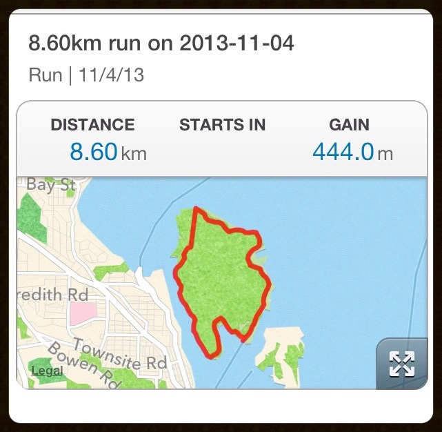
MapMyRun – typical Newcastle Island route
Well, what a surprise I got when an email arrived a few days ago telling me that I had completed 75 workouts using MapMyRun. I apparently covered almost 755k, over 133hrs, oh, and burned almost 54,000 calories. WOW! If I estimate that I only used this app for half my workouts then I probably completed about 150 outdoor fitness adventures from January to November, covering about 1500k. Doing the math, that is an average of 3 per week. Yup, that is about right, at least in the beginning and there were some weeks when I ran everyday. Now I run at least 5 times per week, so it would not surprise me if the next 75 workouts occur much sooner, although, I still don’t map every run, especially on trails that I’m very familiar with.
This is a very handy app, which also allows you to share your run results with others and on Facebook or Twitter, but at the moment I prefer to keep these private. If the routes are shared other MapMyRun users can see them and use them to locate routes. Someday I may start sharing my running routes with the world.
One feature I do love about this app is the positive reinforcement you get at the end of the run: a smiley face with “Good Job!” on the screen. Makes it all seem worthwhile getting up, getting dressed, and getting out!
I am a runner.

Leave a Reply